The Laugavegur Hiking Trail is Iceland’s most famous hiking trail and National Geographic has described the trail as one of the world’s most beautiful treks and a must-do for any hiking enthusiasts.
This 4 to 5-day self-guided hike takes you along Iceland's most famous trekking route, Laugavegur, from the geothermal area of Landmannalaugar through the breathtaking landscapes of Þórsmörk and option to add-on to Skógar. Discover colourful mountains, hot springs, and stunning valleys on this unforgettable adventure.
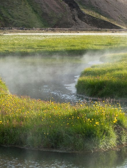
The trail connects the Landmannalaugar and Þórsmörk Nature Reserves and offers a variety of different volcanic landscapes along the way. Every day has different views with beautiful scenery of pristine nature with volcanoes, lava fields, glaciers, natural hot springs, black arctic deserts and lush forested valleys.
For a detailed description please read our free Laugavegur Volcano Trail Online Guide
This self-guided 4-day hiking package includes bus tickets to and from the trail, accommodation in mountain huts in addition to meals on the last day in Þórsmörk. It also gives you an extra day to enjoy trails in Þórsmörk or to head on over the 30-kilometre long Fimmvörðuháls Volcano Trail to Skógar.
Accommodation along the way is provided in mountain huts and on camping grounds. We start the trek in Landmannalaugar and finish at the Volcano Huts in Þórsmörk or you can extend the trek by one or two days all the way to Skógar, south of the Eyjafjallajökull Volcano and Glacier.
If the departure you want is closed you can try to send us an email to [email protected] and we can see if we can fit you in.
1-8 participants
Public bus
56km (35 mi)
4-7 hours
600 m (1900 ft)
Mountain hut, upgrade available to private room at the Volcano Huts
BSI bus terminal in Reykjavík
Jun-Sept
4-5 days
12 years old recommended
Challenging: Suits those that are physically active and have some background in basic traveling in mountainous terrain with a backpack. 6-7 hrs walk per day.
Upgrade to glamping tent or private room accommodation at the Volcano Huts
You start the tour from the BSI coach station in Reykjavik, from whence the mountain bus will take you to Landmannalaugar.
Starting the trek from – Landmannalaugar brings you to an easy hike through the lava field of Laugahraun towards the colourful mountain Brennisteinsalda. There you start a gradual climb through dissected hills with views of an incredible spectrum of colors. After 3 – 4 hours you should arrive at the Stórihver geothermal area and hot springs. About 2/3 of the way is likely to be covered with snow until late summer. At an elevation of around 1000 metres you can expect fog to show up suddenly and without warning. The trail is clearly marked but hikers must be careful not to loose the track in poor visibility. Hrafntinnusker Hut (Höskuldsskáli) will appear suddenly about 2 km past a memorial of a traveler, who sadly died of hypothermia in this area in June 2004. Evening walks from the Hrafntinnusker hut: 20 minute walk to Mt. Söðull (beautiful views) or 40 minute walk to ice caves. Ask warden for more information.
Heading out from the Hrafntinnusker hut the trail takes you through a valley with small ravines that sometimes may be filled with snow. A short and steep incline leads you to the highpoint of today’s walk. If the visibility is good, a side trip to the summit of mountain Háskerðingur (1.281 m) will reward you with a breathtaking view. This is best done from the western slope of the mountain. But take care as you have to cross a glacier on the way. Ask the hut warden for further information. Soon after you will leave the colorful rhyolite mountains and enter an area with contrast of dark palagonite mountains and white glaciers. You will also notice a considerable increase in vegetation. The trail down the Jökultungur is quite steep and care must be taken during the descent. The last few kilometers to the huts by the lake Álftavatn are on flat land. The two huts at Álftavatn take up to 52 persons. Evening walks: Hike up Mt. Brattháls, which takes 1 – 2 hours return. Wet feet are included as it’s necessary to wade the little stream running from Lake Álftavatn. Another good hike takes you up the Mt. Torfatindur (818m), estimated walking time 1 – 2 hours.
The trail leads you over the Brattháls Ridge into Hvanngil Ravine, wading across the small Bratthálskvísl River. In the Hvanngil Ravine you will find two huts, one built for sheepherds in 1963 and one for tourists, built in 1995. As Álftavatn and Hvanngil are only 5 km apart, Hvanngil can be used as an alternate accommodation. The huts have toilet facilities, showers and a small camping site in an old lava field. Leaving Hvanngil you cross a bridge over the Kaldaklofskvísl River. On the eastern bank of Kaldaklofskvísl River the trail splits in two. You should take the path leading south to Emstrur and Þórsmörk. The other branch leads east to Mælifellssandur (Road F 210). Soon after that, another river has to be waded. For a few kilometers, the Laugavegur Trail joins a mountain road. You can stay on the road all the way to the Emstrur hut or take a hiking trail alongside the road. You will have to cross the powerful Nyrðri Emstruá River on a bridge that the road will take you to. After crossing the bridge you will traverse few kilometers on flat land until you suddenly find the Botnar huts in Emstrur. Evening walk: Markarfljótsgljúfur canyon is a 40 to 90 minute hiking tour with beautiful views of the canyons and neighboring mountains.
In about 45 minutes, after heading out from the Emstrur huts you should be on a steep path leading towards the canyon of Syðri-Emstruá River. The river can be crossed on a hiking bridge in a narrow part of the canyon, with the river raging beneath your feet. From the canyon you will be walking through a hilly area known as Almenningar with the first view of Þórsmörk in sight. At the end of Almenningar you will have to wade the Þröngá River the deepest on the Laugavegur Trail. When wading it is good practice to go hand in hand and head downstream or to use hiking poles to keep your balance. After crossing the Þröngá River you will enter the forested area of Þórsmörk. Follow the path to an intersection with signs that show directions to different huts in Þórsmörk. From there you should reach the Volcano Huts in Húsadalur Þórsmörk or Langidalur hut in 30 minutes. You have dinner included at the Volcano Huts this evening, and we recommend as well that you visit the warm natural pool and sauna, which are right next to the huts.
Having successfully finished the Laugavegur trail, you now have the choice of enjoying the day in Þórsmörk and taking the coach to Reykjavik in the afternoon, or hiking over to Skógar via the Fimmvörðuháls trail. The hike over Fimmvörðuháls to Skógar passes between the glaciers Mýrdalsjökull and Eyjafjallajökull, infamous for the 2010 eruption, which affected airline travel worldwide.
No meals are included when hiking. Only one dinner in Volcano huts when you finish the trail and breakfast the morning you leave for Reykjavík. You need to carry your meals but you can lighten your carriage with buying meals from our tiny restaurant in Álftavatn.
The Álftavatn Restaurant is open daily from 11:30 - 23:00 and serves breakfast, lunch, dinner, snacks and drinks at the bar.
DAY1 - Need to carry lunch and dinner
DAY2 - Need to carry breakfast and lunch. - Dinner at Álftavatn. Suggested to buy two lunch pack to take away for eating as breakfast in the next morning and for lunch..
DAY3 - Two lunch packs from the day before from Álftavatn - Need to carry dinner
DAY4 - Need to carry breakfast and lunch - Dinner at Volcano huts (included)
DAY5 - Breakfast at Volcano huts. You can buy lunch on spot additionally if you want to spend this day hiking around Þórsmörk.
We recommend for you to pack light for the hike. A luggage transfer service can be booked through one of our partners South Coast Adventure
All huts have bunk-beds, either with single or double mattresses. You can expect to have to share a bunk with another guest. The wardens assign you a place in the huts, please talk to a warden before entering a hut. Upgrade possibility.
It is not possible to connect to WiFi in any of the first three huts, but you might be able to connect to 4G in some of them as well as along the trail.
There is free WiFi at the Volcano Huts in the main building.
Phone connection can be unstable on the trail and you might have go to the nearest hilltop to find a network.
For 500 ISK you can have a shower at all the huts except in Hrafntinnusker. Get a ticket or coins at the warden's huts, where you can pay with cash or card. For obvious reasons, there are no hair dryers available.
The showers are for free at the Volcano Huts.
Electric plugs can be found at the Volcano Huts but here is no electricity in any the first three huts huts along the way and thus no means of charging electronic devices. Make sure to bring enough power with you. Battery-packs are sold at the huts.
Yes, all of the huts are heated. Some with geothermal water, others with gas. For safety reasons, the gas heaters are turned off during the night.
The first three huts have gas stoves, pots, pans and other kitchen appliance you might need to prepare a meal. We also provide liquid and brush for washing up, tablecloths and tea towels.
You have a dinner and breakfast included at the Volcano Huts.
All huts on Laugavegur have some merchandise for sale. The selection of goods depends on the size of the hut but you should at least find some chocolate or snacks at all huts.
Yes, all huts have water closets except for Hrafntinnusker which only has a latrine. We provide toilet paper and soap for washing hands. The toilets are usually in separate buildings.
The huts all have running cold water that is safe for drinking straight from the tab. Many of the huts have a big pot on the stove with hot water. Please make sure that the pot is always full by putting in as much as you take out.
You can fill your water bottle before you leave the hut, but you can also drink from streams you come across along the trail.
The wardens usually know the weather forecast for the days ahead and they always try to warn hikers if the outlook is bad. Sometimes they might even forbid you to leave the hut until hiking is safe. Be sure to check the forecast for the area you will be hiking in, on a reliable web page like vedur.is.
Must have
Keep your clothes and equipment dry in your pack


 +354 419 4000