+354 419 4000
Here you can find detailed information about Þórsgata, including descriptions of the main segments of the trail.
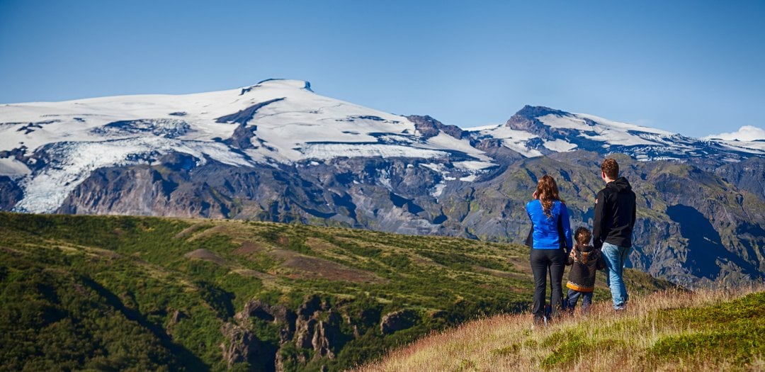
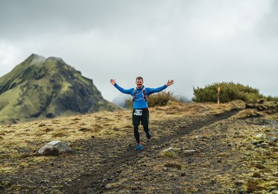
Experience one of Iceland's best hiking and running trails in the heart of Þórsmörk Nature Reserve. Choose easy day trips or multi-day summer excursions for the whole family with accommodation and meals at the Volcano Huts. Þórsgata is an ideal challenge for groups who want to test themselves, build a stronger team and experience the nature of Iceland. Set foot onto the Þórsgata Trail and experience Iceland from up close.
All the best views of Þórsmörk Nature Reserve
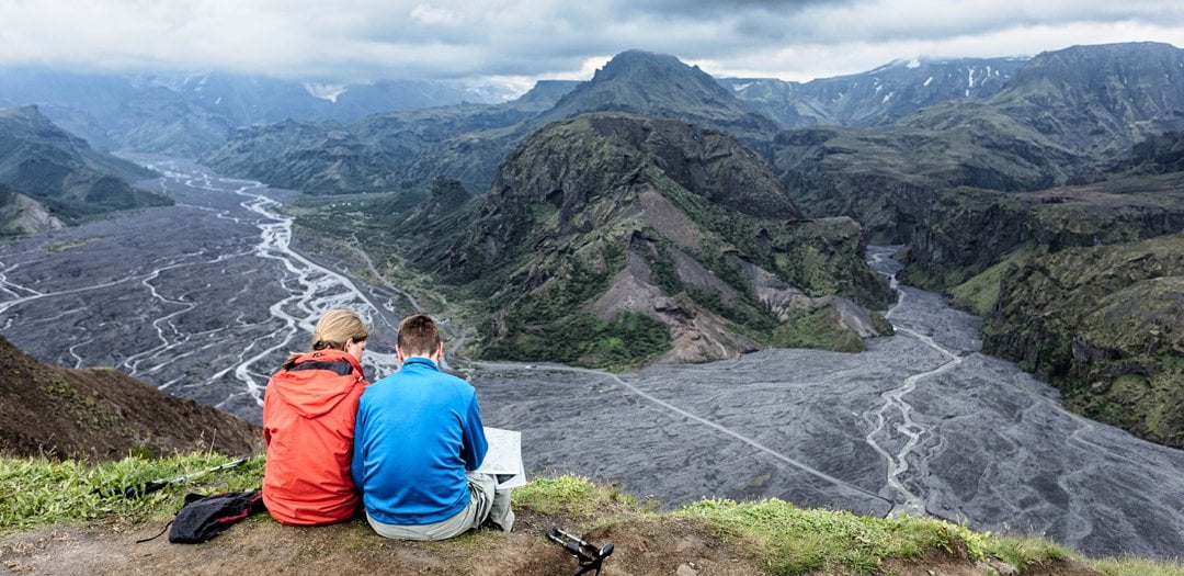
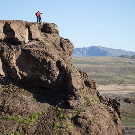
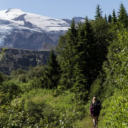
Thorsgata, or Þórsgata as written in Icelandic, is one of the most beautiful and diverse hiking trails in the country, offering a multitude of options to shorten or lengthen the route according to everyone's needs. The mountain views of Þórsmörk and the surrounding areas are unique, and Þórsgata provides people with the opportunity to experience this unique nature from various perspectives.
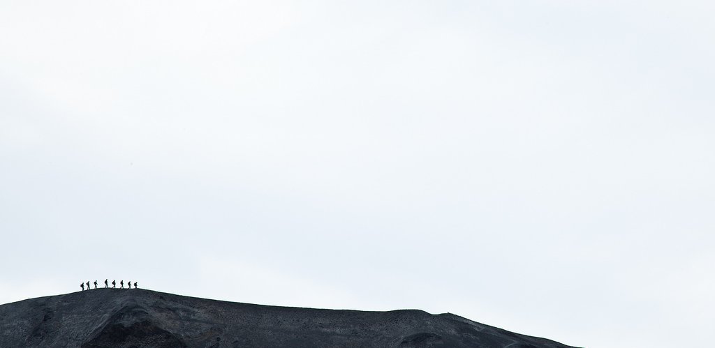
It is possible to walk or run the Þórsgata Trails all in one day for those in good physical condition. However, for those who want to divide it into shorter sections, we have divided the trail into several loops that can be connected to either extend or shorten the route further. Each loop offers beautiful scenery and diverse experiences, ranging from very short walks taking only 20 minutes to full-day hikes with various detours. Hikers can set their own goals to complete Þórsgata in one go or in as many stages as suits each individual.
Þórsgata is an excellent choice for those who want to experience the unique nature of Þórsmörk, as the trail is exceptionally well located between the hiking trails of Laugavegur and Fimmvörðuháls. This means that those who undertake these routes can now add Þórsgata to their itinerary, further enhancing their hiking experience. Þórsgata is also an excellent option for those who cannot cross Fimmvörðuháls due to weather conditions, as the Þórsgata Trail offers a fantastic view over parts of the route over Fimmvörðuháls and Eyjafjallajökull. Click here for a detailed description of Þórsgata.

The entire route is about 17 km long with options to shorten or add detours according to each individual's interests and fitness level. The trail has been divided into several shorter stages that can be connected or shortened as needed."
The trail is accessible to most people, and it's easy to choose sections that offer the same views and experiences while avoiding challenging conditions such as time constraints, increased length, steep terrain, etc. Everyone should be able to find a hiking route suitable for their abilities.
With a bascamp at the Volcano Huts in Húsadalur Þórsmörk, you don't need to carry much with you. Below on this page, you can find a detailed equipment list of items that are good to have with you.
Various accommodation options are available at the Volcano Huts in Húsadalur Þórsmörk. The restaurant offers breakfast, lunch, dinners, packed lunch bags, burgers and light refreshments at the bar.
Hiking trail maps are available at the Volcano Huts in Húsadalur Þórsmörk, and our staff can assist you in choosing the best routes that suit you. Private guided tours can be booked for groups and individuals.
Þórsgata is well-suited for individuals, families, and groups who want to experience the most beautiful nature of Iceland and enjoy good service and facilities at th Volcano Huts between hikes or trail running sessions. It's easy to choose routes that suit everyone.


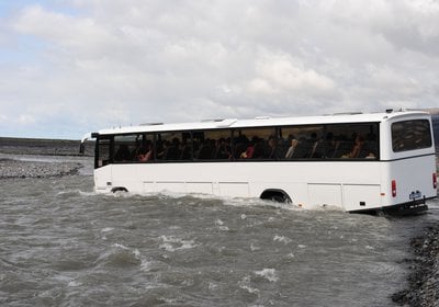
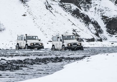
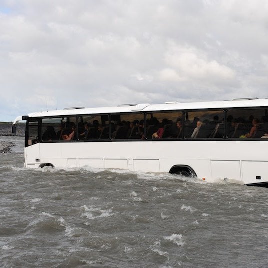
Here you can book a bus trip to Þórsmörk. Daily bus trips with multiple departures per day are available throughout the summer, so everyone should find a departure that suits them. The journey to Þórsmörk is an adventure as it involves crossing many unbridged rivers, so it's better to leave the car behind and take the bus. The route up Þórsmörk Road F249 offers magnificent views and an enjoyable experience. You can catch the bus from BSÍ in Reykjavík, Selfoss, Hella, Hvolsvöllur, and the Brú Base just above Seljalandsfoss.
Here you can find detailed information about Þórsgata, including descriptions of the main segments of the trail.
Here you will find information about accommodation options at the Volcano Huts in Húsadalur Þórsmörk, starting and ending points for the Þórsgata hiking trail.
The Þórsgata Trail begins and ends at Húsadalur in Þórsmörk, but it is also possible to start from Langadal or Básar, depending on what suits each individual.
The Þórsgata hiking trail is the first to open among all the hiking trails in the highlands, and it can be walked well into autumn and even through the winter.
The trail is snow-free from early May, and all paths and steps are usually inspected and repaired by the end of May or early June.
The Volcano Huts in Húsadalur Þórsmörk are open between May 15th and September 30th and available for group bookings between October 1st and May 14th. Daily bus trips to Þórsmörk start on May 1st and run until September 30th.
The journey to Þórsmörk is an adventure, as it involves crossing many unbridged rivers with stunning views in all directions.
Daily bus trips to and from Þórsmörk over the summer make the journey simple and convenient. You can catch the bus from Reykjavík or various stops along the way. It's possible to leave cars and park where the buses stop. See more detailed information about the bus schedule and ticket bookings here.
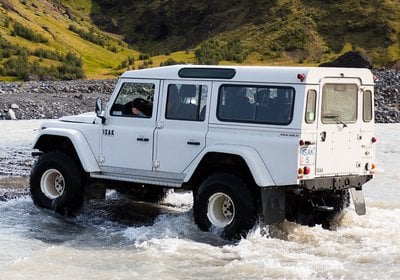
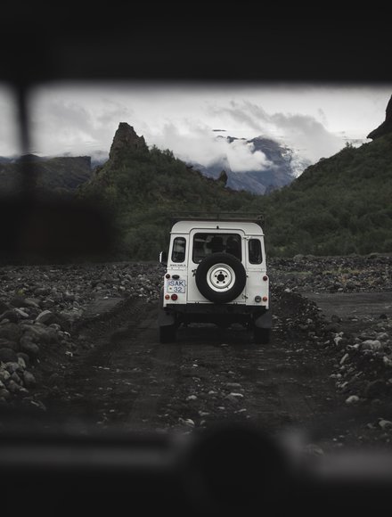
For those with 4x4 jeeps, it's possible to drive up to Krossá, park the car there, and walk across footbridges over the river and to the Volcano Huts in Húsadalur Þórsmörk. Note that a shuttle service across Krossá is not provided.
Fully equipped excursions in modified mountain jeeps are available for those who want to make the most of their journey.
You can book bus trips to Þórsmörk here
The Þórsgata trail is about 17 kilometers long in total, but it's easy to divide it into shorter sections. Most people hike it in one day, for example, doing the Tindfjallahringur with or without Valahnúkur on the first day, and then adding Merkurraninn on the second day before heading back. However, many hikers or runners complete the entire trail in one day. Based on an average hiking pace, the entire trail can take up to 7 hours with good stops in between.
Here you can view more information about the trail and its stages.
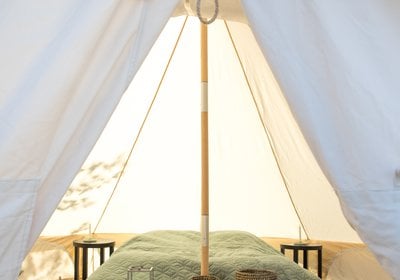
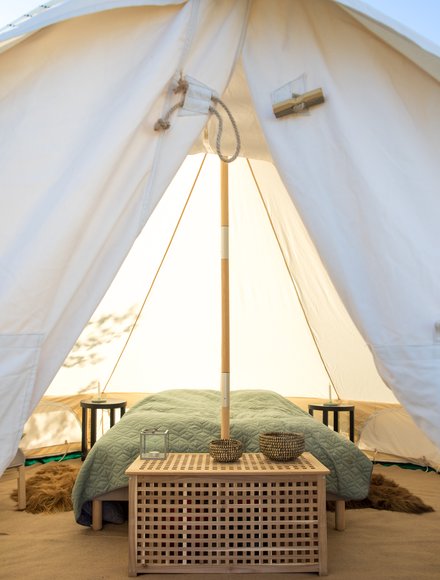
The Volcano Huts in Húsadalur Þórsmörk offer accommodation options, including cottages, fully equipped and heated Luxury Glamping tents, double rooms with pre-made beds, mountain huts, and camping facilities.
See all the options here
The Volcano Huts restaurant offers a variety of catering options including breakfast, lunch, light snacks, dinner and drinks at the bar. Here you can view more information about the restaurant and catering options.
Toilets and showers are available at the Volcano Huts and other huts near the trail, such as the Langidalur and Básar huts. Water bottles can be filled at all these locations, and refilling them in rivers and streams is also safe.
A facility fee must be paid at Langadal and Básar for bathroom access, but not at the Volcano Huts.
Please note that restroom facilities are not available outside the huts and camping areas, so if nature calls suddenly, you may need to find a secluded spot. Carry tissue paper and remember to walk away so no traces are left behind.
At the Volcano Huts, you will find showers, a sauna room, and a small natural pool to soak in after your trek. For more information, click here.
Most people hike the Þórsgata trail in July and August, but it's also popular to hike it in the spring and autumn to experience the fall colours in Þórsmörk along the way.
The weather is generally warmer in July and August, but it can still get cold at night, and any weather can occur at any time of the year. As September and October approach, it starts to cool down, but there are often still ideal conditions for hiking this beautiful trail in the autumn.
The Þórsgata hiking trail is relatively easy and accessible, but it all depends on each individual's fitness level, conditions at the time, and how the hike is organized. The trail has been divided into several loops or sections that are easy to connect or shorten as needed.
If the hike is split over two days, it can be manageable for most hikers in decent shape. The total elevation gain over the entire trail is almost 700 meters, but by walking the loop clockwise, most ascents are gradual, making the uphill sections easier.
Steeper sections are mainly found on the Tindfjallahringur from Slyppugilsdrög, Stangarháls, and the slopes of Valahnúkur.
Overall, Þórsgata is accessible to most hikers, and it's easy to navigate around difficult sections as needed, depending on the terrain and conditions.
Blisters, muscle strain, or chafing under backpacks or between thighs can significantly affect hikers' enjoyment, so remember to bring blister plasters.
The hiking trail is well-marked and visible in the ground. As long as there is no snow on the trail, it's easy to see where it goes and leads you forward smoothly.
Information signs and signposts are placed along the trail, directing you towards the main destinations.
Having a map is essential, and having a compass and even a GPS device with you can be beneficial. However, remember that having these tools is not enough; you must also know how to use them.
A phone is not a substitute for a map, compass, or GPS device but can be a helpful addition.
Hiking trail maps are available at our reception in Húsadal, and our staff assists hikers in finding the best routes that suit each individual.
Our restaurant at the Volcano Huts in Húsadalur Þórsmörk offers a variety of refreshments for hikers. You can purchase breakfast, packed lunches, lunch, dinner, snacks, and light drinks for children. See more details here.
It's good to have a packed lunch readily available at the top of your bag and some energy-rich snacks like protein or candy bars, nuts, chocolate, and raisins in your pocket to nibble on along the way. The packed lunch is good to have at the bottom of your bag and next to your back to distribute the weight in your backpack.
Having a water bottle accessible on the outside of your bag is good, but it's also good to have a container attached to a strap that can be used to scoop water from rivers and streams along the way. This way, you don't need to carry as much weight in water and don't always have to refill at water sources. Water is accessible in many places along the trail.
"It's good to have appropriate clothing, snacks, and equipment for a day hike. It would help if you considered the conditions and weather each time and the estimated length of the hike.
During the summer, lightweight outdoor clothing, a small daypack, a water bottle, and snacks are generally enough. However, warmer clothing may be necessary during other seasons.
It's essential to wear sturdy shoes with good grip. Lightweight hiking shoes or trail runners are acceptable if they're not slippery.
The Þórsgata trail is an excellent hiking route, and under the best conditions, it offers a comfortable hike in unparalleled scenery. Accidents are fortunately not common on the trail.
Usually, there are other hikers on the trail, so if you run into problems, you can ask for help from fellow travellers.
Cell phone reception is good in most areas along the trail, but there are sections with little to no signal. You may need to climb out of valleys and onto mountain ridges at some points to get a signal.
However, many factors can turn a pleasant recreational hike into a demanding and even life-threatening ordeal. Weather, accidents, and inadequate equipment can change the situation quickly, so thorough preparation is always necessary.
Weather conditions can change dramatically; storms can come in quickly with high winds and precipitation. Temperatures can drop significantly, even if it's hot during the day, so be mindful that temperatures can fall below freezing at night, regardless of the season. Fog, snow, and icy patches can obstruct visibility, making navigation difficult.
Most severe accidents in the highlands can be attributed to injuries when falling over or due to hypothermia, where poorly equipped individuals get lost off-trail and succumb to wet and cold weather.
Stay close to the hiking trail, and inform someone about changes in your plans.
Register your travel plans with the Highland Watch at www.safetravel.is.
The nature in the Icelandic Highlands is particularly delicate, and vegetation damage can take many years or even decades to recover. Let's stick to the hiking trails, refrain from littering in the wilderness, and only camp at designated camping areas.
Let's all do our best to protect the nature of Iceland.
Take the pledge to be a responsible traveller by clicking here.